

 Tweet
Tweet
Buzz up!
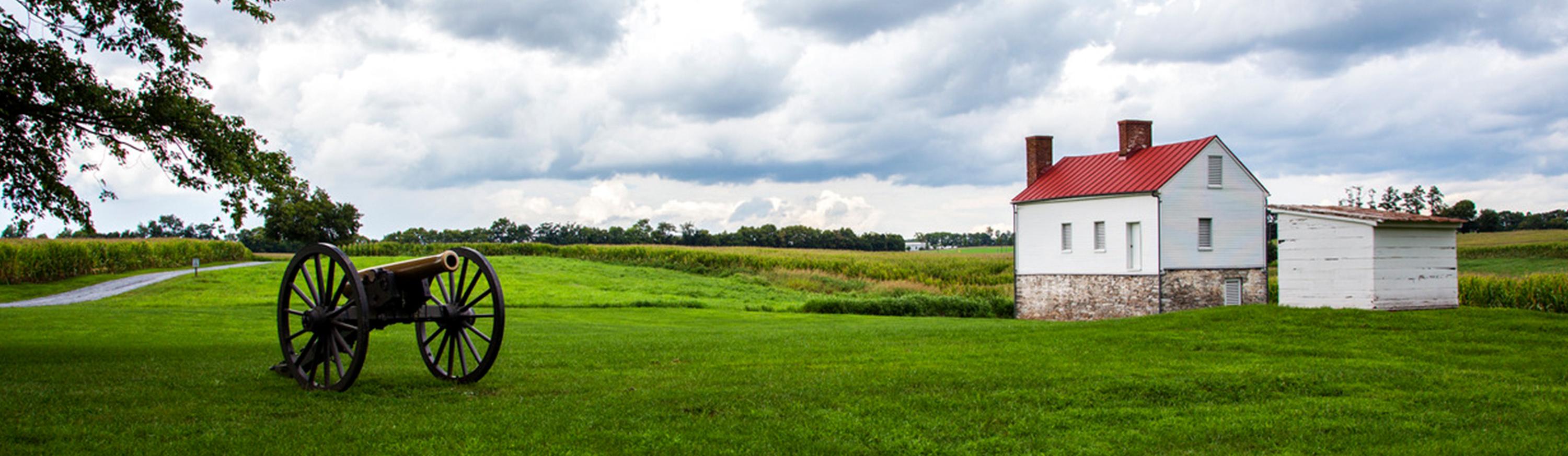
Union forces clashed with Confederates in two separate fights at Rappahannock Station — the wartime name for modern-day Remington — in August 1862 and November 1863.
A major crossing here was the Orange & Alexandria railroad bridge, which the Yankees burned in October 1863, the Library of Congress records.
Both sides wanted control of the vital waterway at the site and many died fighting for it.
Now, a local developer wants to return the place to its roots with the establishment of Culpeper Crossing, a Civil War-themed tourist destination on 14 acres of wooded, riverfront land adjoining the battlefield.
Bob Currier, in addition, has already placed a much larger parcel of actual battlefield into permanent conservation easement.
“We need a Civil War Williamsburg,” said the Remington resident, whose family has owned 100-plus acres at Rappahannock Station for more than a century. “It will be the only thing like it — on a battlefield where trenches are still intact.”
Located about five miles north of the more famous village at Brandy Station — the site of North America’s largest cavalry engagement in June 1863 — Remington sits about half a mile from the Rappahannock River in Fauquier County, though a portion of it sits within the border of Culpeper County.
Currier, who has a background as a builder, plans to get started on his “reproduction Civil War town” on the Culpeper side of the river this spring.
Besides an 18-room bed and breakfast and a museum, the secluded, riverfront development will include shops, a church, restaurant and live theater — the potential for up to 20 buildings in all, according to Currier.
He also plans to incorporate other periods of history relevant to the area including a Native American village, French and Indian War fort and Revolutionary War attractions.
Currier said he’s found hundreds of arrowheads and two dozen stone axes on the property. He wants to offer wildlife exhibits and the arts at Culpeper Crossing as well.
The Virginia Department of Historic Resources sees the possibilities.
“Your concept for Culpeper Crossing offers an exciting opportunity to present the rich history of this area in an engaging format and setting,” wrote DHR director Kathleen Kilpatrick in a letter to Currier last year. “We look forward to working with you to develop a sensitive and important new asset for Virginians and the nation.”
She encouraged “the use of local building tradition … to link Culpeper Crossing with the cultural heritage of its location.” It’s something Currier remains committed to doing as he moves forward, having ordered bronze statues of Gens. George Meade (Union officer from Pennsylvania) and Robert E. Lee of Virginia, who met in Remington.
Civil War soldiers who fought in Culpeper — believed to be the most marched upon county during the war — surely would never have guessed the history-themed recreation that awaits the river land at Rappahannock Station.
One letter in Currier’s collection of correspondence drafted in this area from that time stands out especially.
“I hope the time is not too distant when all who live may see this war ended and peace flow again in one unbroken stream through all our valleys — from east to west and from north to south,” wrote John M. Lovejoy of the 121st New York Regiment, stationed near Brandy Station in 1864.
Conservation easements
Currier wants his family’s land to remain unbroken by rampant development, which has crept closer to Culpeper’s battlefield sites in recent years.
And so about a year ago, he placed 189 acres of Rappahannock Station battlefield — adjoining Culpeper Crossing — into permanent conservation easement, meaning it’s going to stay as is forever.
He admitted that his foremost reason for pursuing the conservation easements through the DHR was for the money — easement holders can sell the tax credits they receive for cash. Currier did just that, getting about $3 million for the tax credits.
According to the terms of the easement designation, the land can never be subdivided and it carries strict limits, for perpetuity, on very limited development.
Currier credited family friend Sandra Stevens, an easement consultant from McLean, for helping him navigate the complicated process.
“What she is doing has dramatically affected the county,” he said of other easement projects Stevens worked on last year, including battlefield land in Brandy Station.
“I wouldn’t have gotten through it without her.”
Property value
Stevens, who has a background in lobbying, began her easement consulting business with Currier back in December of 2008.
“I did his and decided this was something I love doing,” she told the Star-Exponent in a recent interview. “It gives me an appreciation for the value of people’s property and how they feel about it.”
Successfully obtaining easement status is a complicated process, Stevens said, that spans about nine months. In Virginia alone, she said, there are 34 different land trusts, including DHR, the Civil War Preservation Trust and Piedmont Environmental Council, that hold properties in easement.
It’s an altruistic motive to put your land into easement, Stevens said, but these days many folks are doing it for the money too – to save the family farm.
She said she has thousands more acres in Culpeper County “in the pipeline” for easement designation.
The benefit to the county of historic easements is open space preservation, Stevens said.
“The state of open land in the county right on U.S. 29 has definitely changed,” she said. “We won’t be having overpasses and congested traffic areas like it would have been if had been developed as originally planned,” Stevens said, referring to the previously planned large development at Willow Run, property that she helped put into easement in 2009.
Wendy Musumeci, the DHR’s easement program coordinator, said her department holds 1,175 acres in historic conservation easement in Culpeper County.
Of those, 641 acres were added last year, she said, noting, “Future generations have to abide by these land restrictions.”
Culpeper County Planning Director John Egertson, speaking for himself and not the county, said conservation easements are a positive thing for the county because they maintain its overall rural character.
On the other hand, he noted, conservation easements could be detrimental if they prevented development in areas intended for growth, like the county’s technology zone next to the Daniel Technology Center.
“As for the various easements which have put into place to date, I am supportive of them all.”
Union soldier W.H.B. Dudley, camping near “Rapperhannac Station” in September of 1863 did not feel so supportive of the other side.
“We had a nice cav fight,” he wrote to his nephew George Payson. “We drove the rebels about 15 miles; they did run, tore up things good. I could see lots of dead rebels.”

Comment